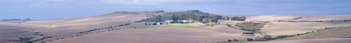
103. 2020.03.11 – Melkhoutfontein. The weird history of “acuminata” is not very flattering. It started with me when I described this as a variety of H. retusa. But I did say some interesting things in 1981 that lead to my present point of view. One is that I said that acuminata may be eventually shown to link H. retusa and H. pygmaea. This is exactly what the present thread is about without any conscious effort to support what I might have predicted. I think I may have changed acuminata to a variety of H. mirabilis in “Haworthia Revisited”? Weird too, but I would not be ashamed. That would reflect the reality – it is one system and countless opinions can be woven around the evidence that supports the idea. The original population of acuminata was destroyed and although I did find plants nearby I did not think such a strong population as this still existed so close by. This population is at Melkhoutfontein on the Gouritz River southeast of Albertinia. The habitat is old river terrace. There were several smaller populations to the north. Coming are populations to the east that inspire further support for the kind of continuities that occur between practically all Haworthia populations.


104. 2020.03.16 – Johnson’s Post plants are also something else. Large clumps on clay pedestals on an ancient river bank? An amazing sight.


105. 2020.03.17 – These plants are at Vleesbaai and I have no doubt that a species name has been coined for them without condemning the need for a name. It is the formal species part that bothers me. From my perspective these are H. retusa ‘pygmaea’. Steven Molteno can give a good habitat description. The conservation aspect is interesting because it is a small rocky area in an expanse of cultivated and heavily stocked lands. The real threat to the plants is the severe stocking pressure and the irony is that grazing is also necessary to keep vegetation under control. I will, I’m sure, come back to the conservation issue.


Steven Molteno – If these are the plants I’m thinking of (they look like it) then they’re all growing on a lone outcrop of quartzitic sandstone of the Skurweberg formation (Ss), Table Mountain Grp. This exposure is a rather eroded ridge very near Vleesbaai, surrounded by a lot of calcrete and alluvium I think.
There’s another (much larger) exposure of this same formation (Ss), not far away to the north. It’s that line of tall hills that runs parallel to the N2, south of the road, and east of Albertinia. Interesting that this larger Skurweberg formation ridge is also home to some unusual mirabiloid-retusoid confluences (the ‘vincentii’ & co. towards the western end of that ridge of hills; pygmaea ‘argenteo-maculosa’ towards its eastern end).
I think this correlation with a specific geological formation is very suggestive of broader connections across this whole Gouritz region.
Soils are very rudimentary on these outcrops. Lithic leptosols, plants growing very close to (or in) bedrock. Eroded grit from quarzitic Skurweberg formation is probably rather acidic, especially with the contribution of broken-down organic material that’s pretty much its only supplement!Up near Johnson’s Post it’s a completely different story though.
There, the geology is very complex, with lots of funny “slivers” of different formations, all parallel to each other but zig-zagging across the flats.
At Johnson’s Post though, the river’s carved out a series of little kloofs in the terrain. The central valley floor is quite wide and filled with alluvium. The haworthias grow along +-north-facing slopes of Kirkwood formation (Kk). It’s often reddish, but here it’s a light-brown (almost a little ‘greenish’?) siltstone with greyish shales and bit of sandstone sometimes. This is what was called the “variegated marls”, and it erodes into a heavy, fine-grained clayey loam. Very muddy if wet. The same formation (Kk) is the main home for H.pygmaea in the Mossel bay and Brakke regions to the east. There is a bit up near Herbertsdale, and a long strip of it going east-west through Riversdale and Heidelberg. Another patch is just east of Swellendam, and I think there’s probably an exposure at Klaasvoogds but its very eroded. Everywhere except Klaasvoogds, it’s inhabited by the floribunda/chloracantha complex. Sometimes also these funny mirabilis-retusa integrades like near Heidelberg.
To return to Johnson’s Post, above the Kirkwood formation you get this pebbly calcarenite (De Hoopvlei fm I think), but it’s on the flatter area on top and I don’t know of Haworthia there. It’s also mostly ploughed though.
Landtypes at Johnson’s Post are also interesting. Eastern part is Fc15. Fc15-39 are lime-rich river valleys, networking across most of the Overberg, that are always inhabited by retusa ‘turgida’ and by one of the floribundoids. Usually not a mirabilis though.
Western part of Johnson’s Post is landtype Ae133 (obviously these aren’t strict boundaries though, they grade). The south-eastern extremity of the same landtype (Ae133) is where those Haworthia at Vleesbaai live – i.e. Ae133 connects these two populations.
There’s a similar landtype, Ae113, just north of the Breede River mouth (!)
Vegtype at Johnson’s Post is what Jan Vlok calls: Southern Cape Valley Thicket. It’s a thin belt that winds along the Gouritz and its tributaries, with a strip along the lower Goukou too. It nearly always has some sort of toothed-leaved floribundoid/chloracanthoid (along the lower Goukou its H.variegata) as well as H.retusa turgida. The correlation in distribution is quite strong. These haworthias almost seem to trace out this vegtype on the map. I think the correlation with a specific geological formation is very suggestive of broader connections across the whole Gouritz region. These sandstones are very much older than the surrounding sediments.